Mizoch
Mizoch (Мізоч, Мизоч, Mizocz, מיזאָטש) is an urban-type settlement in Zdolbuniv Raion, Rivne Oblast, Ukraine, 30 km far from Rivne. Its population was.
The first written record goes back to 1322. The confirmation of the city's legal status dates from 1429. In 1761, the King Augustus III of Poland granted Mizocz the Magdeburg Rights. The civic self-government placed the city Velykyi Mizoch (Greater Mizoch) in the Luts'k district. Between world wars, Mizocz was a multi-ethnic community like many others in eastern Poland, inhabited by Jews, Poles, and Ukrainians. There was a military school in Mizocz for the officer cadets of the Battalion 11 of the Polish Army's First Brigade; the Karwicki Palace (built in 1790, partly destroyed by the Bolsheviks in 1917), Hotel Barmocha Fuksa, a Catholic and an Orthodox church, and a Synagogue. The nearest major city was Równo.
In World War II, the town was invaded twice. It fell under the Nazi occupation in 1941. The Jewish inhabitants were first forced into the newly formed Mizocz Ghetto, from which they were taken out and slaughtered at a nearby ravine.
In January 1989, the population was 4220 people.
The Gonfalon and modern emblem were approved by the city council on September 11, 1996.
Map - Mizoch
Map


Country - Ukraine
 |
 |
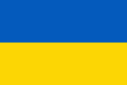
| Flag of Ukraine | |
During the Middle Ages, Ukraine was the site of early Slavic expansion and the area later became a key centre of East Slavic culture under the state of Kievan Rus', which emerged in the 9th century. The state eventually disintegrated into rival regional powers and was ultimately destroyed by the Mongol invasions of the 13th century. The area was then contested, divided, and ruled by a variety of external powers for the next 600 years, including the Polish–Lithuanian Commonwealth, the Austrian Empire, the Ottoman Empire, and the Tsardom of Russia. The Cossack Hetmanate emerged in central Ukraine in the 17th century, but was partitioned between Russia and Poland, and ultimately absorbed by the Russian Empire. Ukrainian nationalism developed, and following the Russian Revolution in 1917, the short-lived Ukrainian People's Republic was formed. The Bolsheviks consolidated control over much of the former empire and established the Ukrainian Soviet Socialist Republic, which became a constituent republic of the Soviet Union when it was formed in 1922. In the early 1930s, millions of Ukrainians died in the Holodomor, a man-made famine. During World War II, Ukraine was devastated by the German occupation.
Currency / Language
| ISO | Currency | Symbol | Significant figures |
|---|---|---|---|
| UAH | Ukrainian hryvnia | â‚´ | 2 |
| ISO | Language |
|---|---|
| HU | Hungarian language |
| PL | Polish language |
| RU | Russian language |
| UK | Ukrainian language |